
Maps of the Holy Land


The Maps of the Holy Land
“Holy Land” commonly refers to the lands between the Mediterranean Sea and the Jordan River (with adjacent deserts and highlands), sacred to Judaism, Christianity, and Islam. What follows is a concise, reader-friendly timeline you can place alongside your maps.
- Bronze & Iron Ages (c. 3000–586 BCE): Early Canaanite city-states interact with Egypt and Mesopotamia. Later, the biblical kingdoms of Israel and Judah arise; Assyrian and Babylonian conquests culminate in the fall of Jerusalem (586 BCE).
- Persian & Hellenistic Periods (539–63 BCE): Under the Achaemenids, exiles return and the Temple is rebuilt. After Alexander the Great, competing Hellenistic dynasties rule; the Maccabean/Hasmonean state emerges, blending local rule with Hellenistic influence.
- Roman & Byzantine Eras (63 BCE–7th c. CE): Rome annexes the region; the Second Temple is destroyed (70 CE). Late antique Christian pilgrimage flourishes under Byzantine rule; cities like Jerusalem, Caesarea, and Gaza become important Christian centers.
- Early Islamic Caliphates (7th–11th c.): Rashidun/Umayyad/Abbasid dynasties integrate the land into wider Islamic realms; Jerusalem (al-Quds) gains prominence with the Dome of the Rock and al-Aqsa Mosque.
- Crusader & Ayyubid/Mamluk Periods (1099–1517): Latin Crusader states (Kingdom of Jerusalem, etc.) hold coastal and inland nodes. Saladin retakes Jerusalem (1187). Mamluk administration stabilizes trade/pilgrimage routes and cities.
- Ottoman Rule (1517–1917): The region is administered as part of Ottoman Syrian provinces. Nineteenth-century reforms, population growth, and new roads/railways reshape towns and farm economies; Western mapping and archaeology accelerate.
- British Mandate (1917–1948): After WWI and Ottoman collapse, Britain governs the territory under League of Nations mandate. Intensifying national movements and immigration set the stage for partition proposals.
- UN Partition & After (1947–): The UN recommends partition with economic union (Resolution 181, 1947). The 1948 war follows, and the region’s political geography and boundaries continue to be contested and negotiated up to the present.
Annotated Bibliography
- Abraham Ortelius, Terra Sancta (first issued 1584; 1606 ed.). Classic early modern cartography of the biblical land; useful for illustrating how early atlases visualized sacred geography. Public Domain.
- Survey of Western Palestine (Palestine Exploration Fund; Conder & Kitchener, 1870s–80). The benchmark 19th-century topographic/cadastral survey; ideal for historical place-name alignment and route studies. Public Domain (PD-scan/Crown copyright expired).
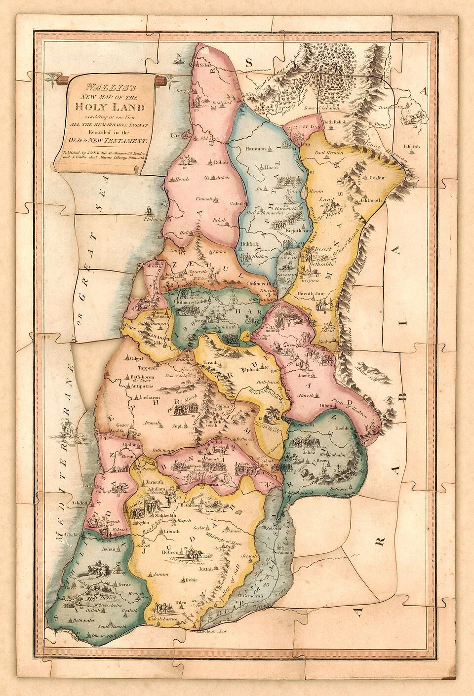
- Wallis’s New Map of the Holy Land (1815). A pictorial devotional map that links biblical events to places; excellent for educational sidebars and heritage design. Public Domain.
- Hammond’s Pictorial Map of the Holy Land (1960). Mid-century American map; visually engaging for outreach materials. Public Domain in the U.S. (copyright not renewed).
- George Adam Smith, The Historical Geography of the Holy Land (1894/1920 eds.). Still-useful narrative geography tying terrain to biblical history; pairs well with your PEF and Ortelius plates. Public Domain.
- General History Overviews. Encyclopaedia Britannica entries on Palestine, the Crusades, and the Ottoman period provide concise, neutral summaries for non-specialist readers; good for quick fact checks and framing text.
- UN General Assembly Resolution 181 (II) (1947). Primary document for teaching the modern international framing of partition proposals; link in footnotes for reference.
Copyright © 2025 | Living Word Bibles | All Rights Reserved